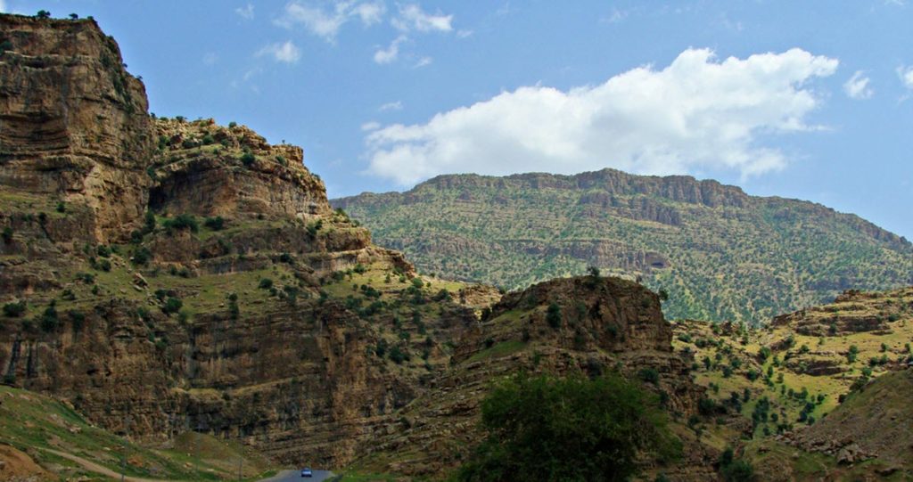
Stretching across the western and southwestern regions of Iran, reaching into eastern Turkey and northern Iraq, the Zagros Mountains hold an extraordinary place on the geographical and cultural map of the Middle East. The following sections detail the distinct geological formation, diverse ecology, rich historical context, and contemporary relevance of these magnificent mountains.

The Geology of the Zagros Mountains
Formed during the late Cretaceous Period as a result of the Arabian Plate colliding with the Eurasian Plate, the Zagros Mountains are a striking example of continental collision and crustal folding. This orogenic process has resulted in a mountainous landscape characterized by long, parallel limestone ridges separated by intermountain basins.
These mountains form the southeastern boundary of the high plateaus of Anatolia, extending approximately 1,500 kilometres from Lake Van in the north to the Strait of Hormuz in the south. The range measures over 200 kilometres wide, with its highest peak, Zard Kuh, standing at an elevation of over 4,000 meters.
Ecological Diversity of the Zagros Mountains
The Zagros Mountains, with their diverse climatic conditions and range of altitudes, are a hub of biodiversity. They play host to the unique Zagrosian ecosystems, which include forest, steppe, and desert habitats.
One of the distinctive features of these mountains is the Zagros Forest Steppe ecoregion. These forests are primarily composed of oak species, along with Persian turpentine, maple, and wild pistachio and almond. This region is also home to a rich variety of fauna, including mammals like the Persian fallow deer, wild goat, grey wolf, and the endangered Persian leopard.
The Historical Significance of the Zagros Mountains
Historically, the Zagros Mountains have been a cradle of civilization, inhabited by humans for tens of thousands of years. Archaeological excavations in the area have revealed traces of some of the world’s oldest known agricultural communities.
The Zagros region was home to some of the earliest civilizations, including the Elamites in the 3rd millennium BC and later the Medes and Achaemenids. These mountains have witnessed empires’ rise and fall, trade routes’ evolution, and significant cultural and linguistic developments.
Prominent historical sites, such as Persepolis and Pasargadae, lie in the proximity of the Zagros Mountains. These UNESCO World Heritage Sites provide a glimpse into the architectural prowess and the cultural richness of the Persian Empire.
The Modern Zagros: Resource Hub and Cultural Landscape
In the contemporary context, the Zagros Mountains remain integral to the regions they span. They serve as a crucial source of water, with numerous rivers originating from their snow-capped peaks. The rivers support agriculture and are harnessed for hydroelectric power generation.
The mountains are rich in natural resources, including extensive mineral deposits and significant oil and natural gas reserves. Therefore, they have become central to Iran’s energy economy and the broader region.
Culturally, the Zagros Mountains continue to be a vibrant mosaic of different ethnic groups, including the Kurds, Lurs, Bakhtiari, and Qashqai, each preserving their distinct traditions, languages, and ways of life.
The Zagros Mountains are also a destination for ecotourism and outdoor activities, with national parks such as the Kūh-e Dīnār and Bābā Qarā Nature Reserve offering opportunities for hiking, wildlife viewing, and exploration.
From the perspective of geology, ecology, history, and culture, the Zagros Mountains reveal a narrative of continuous change and adaptation. They encapsulate the dynamic processes of our planet, the diverse tapestry of life they nurture, and the deep-rooted human civilizations that they have cradled.